
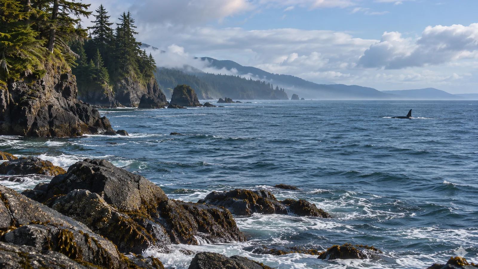
A killer whale travelling through a channel off Vancouver Island may be searching for food, moving between coastal areas or passing through on its way somewhere observers cannot see. Many North Pacific humpback whales make a different kind of seasonal journey, connecting high-latitude feeding areas with warmer breeding waters. Both can swim long distances, and both can appear to be headed somewhere when you see them from a boat. To understand the difference, look at the scale of the movement, the animal’s population and the evidence that links one sighting to another. The direction of a single surfacing sequence gives you only a small part of that picture.
Resident killer whales can cover a wide area
Northern Resident and Southern Resident killer whales are separate populations off the Pacific coast. Here, resident is a name used for fish-eating populations with particular social and ecological characteristics. It describes the whales you are talking about. It provides no fixed home address for an individual orca. Fisheries and Oceans Canada describes seasonal use of certain coastal areas and broader movements during periods when the whales are less concentrated in inland waters. Some places feature strongly in a population’s seasonal record. Other stretches of coast matter at different times. DFO resident killer whale recovery strategy
Consider Johnstone Strait. A portion of the Northern Resident population regularly uses Johnstone Strait, the southeastern part of Queen Charlotte Strait and adjoining channels during summer and fall. The pattern is significant enough to inform critical habitat designation. A boat passing through the region on a given day might still miss them. They might be in a different part of the area, using another part of the coast or outside the observer’s field of view. Seasonal occupancy describes a pattern that researchers found in records across time. It cannot tell a visitor where an individual will be at noon.
Even within a named population, a seasonal description may fit some groups better than others. Look for words such as “portion,” “pod” and “population” when you read a summary. A statement about part of the Northern Resident population can be accurate without describing the movements of every family. The more specific the statement, the easier it is to tell whether a new sighting fits the pattern.
Follow the food question first
Resident killer whales in British Columbia rely heavily on Chinook salmon. The recovery strategy also identifies chum salmon as a secondary prey species and links seasonal distribution and movement to the availability of preferred prey. Different salmon stocks move through coastal areas at different times. A concentration of returning fish gives whales a reason to visit an area, although a person looking from a boat may see very little of the feeding taking place below the surface. A timing pattern in whale records can be consistent with prey availability even when a particular whale’s activity on a particular afternoon remains unknown.
Bigg’s killer whales have another food base. They feed on marine mammals, and their distribution has to be considered in light of their own prey and population history. A fish-eating group’s relationship with a local salmon run cannot explain the presence of a marine mammal-eating group in the same channel. Identification matters when you draw a conclusion about why whales are there. Visitors can ask whether a group has been identified and how the guide recognised it. A distinctive dorsal fin or a photo matched later may allow an identification that travel direction alone could never supply. Canadian killer whale status assessment
If your sighting report simply says “orcas,” keep that level of certainty in a trip journal. The observation is useful as a record of the encounter. It gives you fewer clues about what the whales may be doing than a photograph or a confirmed identification would. Eagle Eye’s guide to orca diets
How North Pacific humpback migration works
Many humpbacks seen off British Columbia spend part of the year feeding in productive higher-latitude waters and travel to warmer waters for the breeding season. This pattern connects different places serving different roles in the annual cycle. The Canadian recovery strategy also describes individual variation in migration timing and reports that some humpbacks can be present in Canadian waters in any month. A reader should allow for that variation when describing a late-season or winter sighting. DFO North Pacific humpback whale recovery strategy
The feeding and breeding areas can be far enough apart that an observer will usually experience only one part of the annual cycle. A whale photographed in coastal British Columbia gives you a record from the feeding side of its year. A corresponding identification from a breeding area may reveal part of the other side. Researchers can compare photographs of the markings and shape of a humpback’s tail flukes to help establish identity. With records from both areas, they can connect an individual with two places. The photographs alone leave much of the connecting route to be investigated.
A humpback can travel a considerable distance while using coastal feeding habitat too. It may move between patches of prey or different parts of the coast. If it is seen travelling through a channel, its direction is a local observation. Calling that movement the start of a breeding migration would require additional evidence. This is especially important around the margins of the usual season, when a traveller might be tempted to read a late date as proof that an animal is leaving.
What a route line on a map actually represents
Imagine a map with two orca observations, each showing the same identifiable whale several days apart. One point marks where it was seen early in the week. A second point marks the next confirmed encounter. A straight line between them measures a connection between locations on paper. The whale could have travelled via several channels, followed part of the outer coast or paused in a productive area. Observers would need additional sightings or an appropriate tracking study to say more about the course it took.
The same principle applies to two humpback photographs from distant places. A match may establish a long-range connection between a feeding and a breeding area. Gaps between records may hide pauses, detours or movement through places where nobody was looking. When a map comes from a research paper, look at its legend and methods. Points from photographs, positions recorded by a tag and lines added to illustrate broad connections provide different kinds of evidence.
A winter gap is particularly hard to interpret. Rough conditions, short daylight hours and less survey effort can leave some waters with sparse coverage. Hydrophones can extend the evidence by detecting calls when whales vocalise within listening range. A recording still depends on the animals making detectable sounds and the equipment being deployed in a relevant area. A listening record and a photograph can answer different questions about the same population.
A field example from Campbell River
Suppose your guide points out several orcas travelling in the same direction, then sees a humpback surface later in the outing. You have two local encounters. The orcas may have been moving through a part of their coastal range. The humpback may have been using feeding habitat. If you can see an animal’s direction of travel over several surfacings, you can add that detail without assuming why it is moving. Identifying the orca population or the individual humpback can make the observation more informative for someone comparing records across seasons.
There may also be breaks in the encounter. The boat changes orientation, you look through rain or glare, or the whales remain submerged for several minutes. Your field notes can indicate where your view ended. If you hear a later report from another part of the coast, the time, identity and location can help establish whether it is likely to refer to the same animals. Similar-looking fins or two groups heading the same way leave more uncertainty.
An informed guide can help put such an encounter in context from a responsible viewing position. Ask how the group was identified, what can be inferred from the behaviour and where scientists have records for the same population. If you want time to compare what you see with the coast around you, review the longer departure’s trip details before choosing. Wildlife, route and viewing conditions depend on the day. Eagle Eye’s Campbell River whale watching tour
Read a seasonal claim in three steps
Start with the animal. Look for the species and, where possible, the population or individual. A month-by-month summary of all orca observations can combine groups with different prey. A record of a single identified whale can be useful for tracking an individual without representing the range of every animal in its population. The grouping in the source determines which conclusions you can draw.
Then check the geography. “Coastal British Columbia” encompasses far more habitat than one viewing area near Campbell River. A seasonal pattern across the province can coexist with brief local appearances. A concentration in a strait during one season can reflect repeated use by part of a population, while records from the open coast tell a broader story. Keep the geographic unit with any statement you repeat.
Finally, look for the years and the collection method. A guide may describe what was observed recently. A federal recovery strategy synthesises a wider body of evidence, and a new study may investigate a narrower question with another method. You can use a current observation to understand one day and a body of research to understand a seasonal pattern. Those are different time scales, and both can be useful to a traveller.
When the same place serves different purposes
A channel may be both a place where whales feed and a connection between other areas. A whale photographed there at the same time of year across several years may show recurring seasonal use. To tell whether it was feeding, look for observations that bear directly on that question. The timing of salmon movements, recordings of calls and clear evidence of prey can each help, depending on which whale is present. The name of the place alone does not supply its role. When a map identifies an area as important habitat, read the description of the functions it supports. That explanation is often more informative than a dot or shaded outline.
Frequently asked questions
Does the word resident mean the whale stays near Vancouver Island all year?
It identifies a particular kind of killer whale population in this context. Northern and Southern Residents move within broad ranges. A location used repeatedly in summer or fall may account for only part of a population’s range over the rest of the year.
Do humpbacks leave British Columbia at the same time?
Individuals vary in the timing of their seasonal movements. There are records from Canadian waters in all months, even though most British Columbia humpbacks undertake long seasonal movements between feeding and breeding areas.
Can I tell where whales are going from the boat?
You may be able to see their immediate direction of travel. A destination or annual route requires evidence from beyond the encounter. Ask whether researchers have previously identified the animal in another area and what the records show about its use of coastal waters.
Should I use a migration map to choose a Campbell River tour date?
Use it to understand the wider geography of whale movements. Compare it with the operator’s seasonal departure information and keep your plans open to the wildlife encountered that day. The route and timing in a migration study cover different scales from a single outing. Eagle Eye’s Campbell River orca guide