
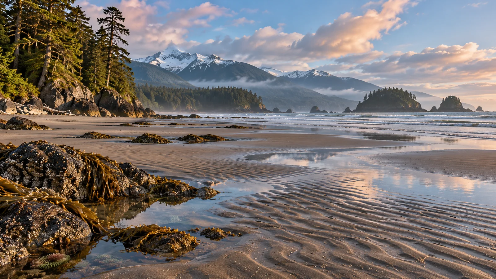
Visit Miracle Beach Provincial Park during daylight around a predicted low tide if you want to see its exposed sand and tide pools. Check the Canadian Hydrographic Service’s station information and confirm the conditions at the beach. Start at the south day-use area for the main beach facilities, or choose the north parking lot for forest and estuary trails. Keep a clear route back as the water rises. BC Parks Miracle Beach Park · Canadian Hydrographic Service tide stations
Check the tide before choosing your arrival time
Look up the date you want to visit and select an appropriate coastal tide prediction station. The Canadian Hydrographic Service provides station locations and predicted high and low water times and heights. Check that the station applies to the area you’ll visit and read the time zone and units. Use the prediction to pick a daylight window, then confirm the shoreline conditions when you arrive. A lower prediction generally offers more exposed ground at a given beach, but wind, waves and local features affect what you can reach. Canadian Hydrographic Service tides, currents and water levels
Give yourself time before the predicted low to reach the beach, look at the shore and see how quickly the water is moving. If you arrive at the lowest predicted time, your return will take place during the following rise. Pick a route that stays connected to the dry shore. Watch for channels filling behind you, especially if part of the beach looks like a raised stretch of sand when the water is out. Use a point where you can look back and check how you’ll reach the parking area again.
Choose how much time you want on the beach in addition to driving and getting ready. A family carrying food or changing footwear needs time at the car. If you have only a short window, stay near a clear access and look at one part of the shore. If the lowest tide falls after dark or you’re arriving with a narrow schedule, choose a different date for tide-pool viewing and use the paths or picnic area for this visit.
Choose the south or north day-use area
BC Parks locates Miracle Beach about midway between Campbell River and Courtenay. From Highway 19, the park directs drivers to take Exit 144 at Hamm Road to Highway 19A, then follow Miracle Beach Drive into the park. Use the park map to identify the day-use lot you want before you arrive. Check park notices and allow for a change of access if there’s maintenance or the first lot is full.
The south lot serves the beach day-use area. BC Parks lists a picnic shelter, picnic tables, change facilities and flush toilets there. It also describes this as the most popular swimming area. Use it if your group wants to combine a look at the exposed shore with lunch or needs a place to change. Check whether a facility is open for your date and ask about the approach if you need information about surface, grade or distance.
The north lot serves nature trails, the Black Creek estuary and the north beach. BC Parks lists pit toilets and an information shelter there. Choose it when you want to start with a forest walk or see the estuary from a designated route. Dogs are prohibited from the estuary and north beach, and BC Parks identifies a designated dog-walking trail from the north parking area. Use the current map and signs to choose a permitted route if you’re bringing a dog.
Look closely at tide pools without disturbing them
BC Parks describes tide pools and marine life at low tide. Begin near a spot where you can return directly to shore. Give your eyes time to adjust and watch one pool before moving to the next. You may see movement that was easy to miss while you were walking. Look for differences between open sand, areas with shells and the ground around rocks. Watch from firm footing and use binoculars or the camera zoom if reaching a spot would mean stepping through a pool.
BC Parks asks visitors to leave shells and organisms in the park and avoid touching them. It also asks that any overturned rock be carefully returned to its original position. Leave rocks in place while you look for animals in the pools and along their margins. With children, ask them to find something moving and describe it while it’s still in the water. Give animals space and keep the group where the footing and route back are clear.
You can make a brief visit about the difference between one pool and another. Try looking at a shallow pool near the sand and then observing a darker edge from a safe place. Compare shade, the surface and how much water the pool holds. If you take pictures, make one showing the setting and one detail you can see from where you’re standing. Keep wet hands and gear away from living things and leave the place as you found it.
Leave room for the change in water level
The open sand can make distances hard to judge. Before walking farther out, look back and choose a visible access to return to. Pay attention to where water is coming in and whether your return crosses a channel or uneven ground. Head back before the route becomes narrow or unclear. Keep children close and choose an earlier turnaround if anyone walks slowly or needs extra help on wet ground.
Bring footwear for sand, shells and slippery areas. BC Parks notes that the beach includes rocky sections with barnacles and shells. If you want to swim as well as explore, check current conditions and water advisories separately. The park has no lifeguards. Keep close supervision near water and choose the beach activity that fits the conditions and the people with you. Island Health beach sampling and advisories
On a windy or rainy day, plan a shorter shore visit. A picnic shelter or a forest trail can give the group a place to spend time before returning to the beach. Look at the actual water and weather before extending the visit. A tide prediction can suggest when you’ll see more beach, while a change in wind and waves may give you reason to spend more time on land.
Add a walk or a Nature House stop
BC Parks describes about two kilometres of walking trails in the park, with many starting from the north beach parking lot. Use those if you want more time in the forest or a different view around Black Creek. Follow the marked route and protect the estuary by staying out of closed areas. The park also describes a viewing platform and fish weir near the park office, with signs explaining the site. Check where it is before deciding whether it fits your walk.
The Nature House runs seasonally. Check the current dates and hours before making it part of your visit. If it’s open, it can give a child or adult a chance to ask about something seen on the beach. If it’s closed, look for the park’s outdoor interpretation or choose one question to follow on the walk. You can still learn something from the differences between the beach, the estuary and the forest.
Fit the low tide into a Campbell River visit
Treat a suitable low tide as a time window if the beach is your main reason for coming. Choose the point in the day when you’ll have light and enough time to reach the shore and return. Then arrange a meal or another stop around it. If you want to book a marine wildlife outing, Eagle Eye Adventures offers a four-hour trip from Campbell River. Check its meeting point and arrival instructions and allow travel time between the park and the marina. If the beach window overlaps with the boat, use separate days or change which outing comes first. Eagle Eye Adventures four-hour marine wildlife tour · Eagle Eye Adventures meeting location
Which lot should I use for the first visit?
Use the south day-use lot if you want beach facilities and a place to change or picnic. Choose the north lot for a visit focused on trails and the estuary. Check the map if you are bringing a dog or need to confirm a specific route from parking.
Is the exact low-tide time the only time to explore?
The surrounding daylight window can be useful, depending on predicted heights and what you see at the beach. Look for a route that stays clear and watch where the water reaches during the visit. Pick an early turnaround if the group needs more time to return.
Give the visit a simple route
For a first trip with children, use the south lot if the facilities you need are open. Before walking towards the water, choose a place to stop and a visible feature for the return. Keep the walk short enough that you can spend time at one pool. Let children choose what to look at and talk about what they see while staying on safe footing. Return before anyone is cold or tired and use the picnic area for a break. You can go back to the shore later if the tide and conditions still suit the group.
If you’re travelling with someone interested in birds or plants, consider starting from the north lot and using a signed trail before heading to a permitted beach area. Give the estuary its own time to watch quietly from the route. On the shore, compare the line of the estuary with the open water beyond. Check where paths meet the day-use area so you know when you’ll need to turn back. If the group includes a dog, use the park’s map to plan the permitted trail separately.
A person looking for an easier approach can ask about the route from the lot to the shore before going. A short approach on a path and a longer walk on wet sand involve different footing. If you want to see the beach without walking far onto it, look for a public viewpoint or a place to sit at the day-use area. Plan the visit so everyone can see the shoreline and return together. Someone who wants to explore farther can agree on a time and place to regroup.
Compare two visits at different tides
If you’re staying in the region, visit once when the beach is more exposed and once when the water is closer to shore. Look at the same place from the same viewing point, then compare what you can see. A stretch of sand that was easy to reach in the morning might be underwater later, while the high-water view can reveal how the shoreline is shaped. Use the prediction to choose the two windows and keep both visits on routes that have a clear return.
For a single visit, take a few minutes to observe the water from shore before heading out and again before you leave. Notice where the edge has moved in relation to a visible rock or feature. The observation gives you a better sense of what the prediction meant on that day. Leave extra time to change footwear and gather picnic gear before heading back to the road.
If you’ve come with a group, ask what each person noticed on the way back. One person may have seen changes in the water while another noticed how the plants along the shore differed.