
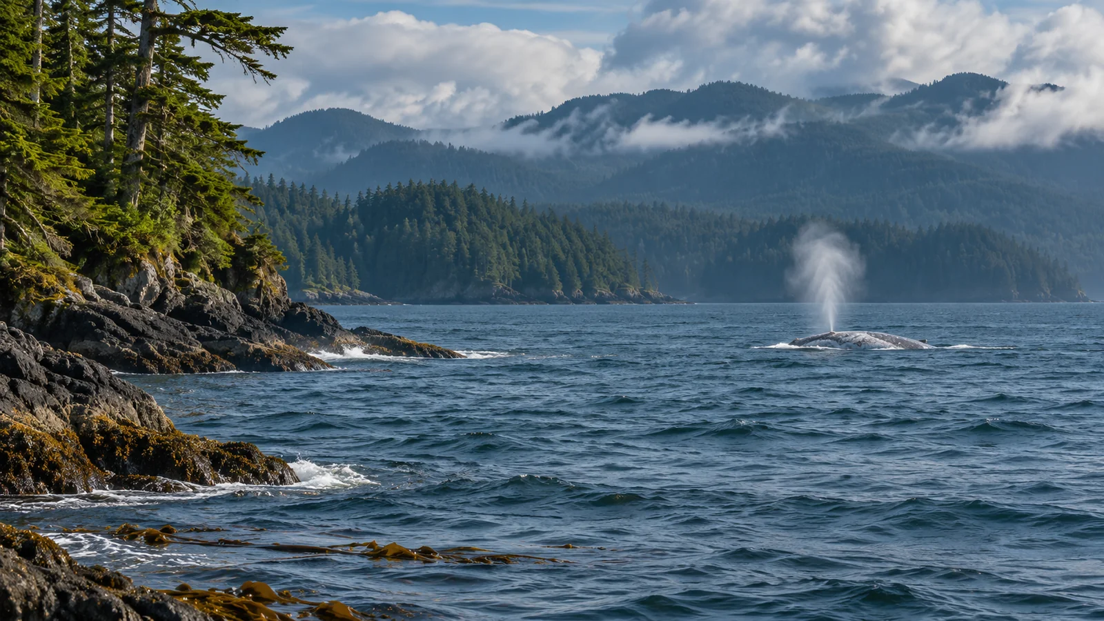
Vancouver Island’s west coast sits along the migration route of many grey whales travelling between wintering waters off Mexico and feeding areas farther north. In spring, northbound whales pass the outer coast on their way towards Alaska and Arctic waters. Whales travelling south later in the year also use the coast, though their distance from shore and visibility can differ. Some grey whales stop to feed or spend much of their feeding season along the Pacific coast, including around Vancouver Island. The protected waters east of the island are a different setting from the open Pacific route. Parks Canada grey whales in Pacific Rim National Park Reserve DFO recovery potential assessment for grey whales in Canadian waters
If you’re looking at a map, trace the island’s Pacific-facing shore from its southwest end toward its northern tip. That coast forms part of a much longer journey. A whale seen there in spring could be passing through on its way north or using a place to feed. A shoreline view records one stretch of the animal’s route. It seldom shows how far the whale has travelled or where it will spend the summer.
Where the island sits between Mexico and northern feeding grounds
Many eastern North Pacific grey whales winter in waters off Mexico, including the lagoons of Baja California. They travel north along western North America towards feeding areas in Alaska and the Arctic, and later return south. The outer coast of Vancouver Island gives northbound whales a route along the continental margin and gives people on the island a view of part of that route. The time an individual passes can vary with its departure, travel pace and where it goes along the coast. NOAA Fisheries eastern North Pacific grey whale overview DFO grey whale recovery potential assessment
The route is a corridor rather than a single line on the water. Some whales pass close enough to be visible from land. Others travel farther offshore, and the distance can change as they move around points or across open water. The DFO assessment describes generally similar corridors in both directions and some differences in how far offshore animals can travel. The coast visible from a single headland is only part of the area they can use.
Farther north, whales can travel through another series of channels and stretches of open coast. A Canadian assessment describes work with shore observers and satellite-linked tags that showed many whales using a coastwise route through Hecate Strait. Those observations concern a different part of the journey. They help show why researchers combine information from several regions to reconstruct movement past British Columbia. COSEWIC grey whale status report, distribution and migration routes
What the northbound passage looks like in spring
Parks Canada highlights grey whales on the west coast of Vancouver Island in March as they return north. The broader spring passage stretches across more than one month. Whales may pass at different times, and a pair with a calf can travel at a different stage of the movement from other adults. DFO notes that mothers with calves often move closer to shore during northbound migration. The position of an individual pair still varies with the coast and conditions. Parks Canada seasonal wildlife in Pacific Rim National Park Reserve DFO grey whale recovery potential assessment
From shore, the easiest part to see may be a blow against darker water or a patch of sky. Look for a repeated movement in one direction. A whale that surfaces at intervals along the same line may be travelling, while one that returns to the same general area may be doing something else. Note the actual direction rather than assuming every whale in spring is moving north. A whale can change its immediate heading as it goes around a point or uses a local feeding area.
A broad seasonal window helps explain why an observation can vary between visits. Cloud, wind and swell can hide a blow or the back of a whale that stays farther offshore. If you see no whale during a short watch, you know what was visible during that visit. A dedicated survey over repeated days offers a different way to assess the timing and volume of passage.
What changes on the southbound journey
After feeding farther north, many whales head south again towards wintering areas. The return uses the same broad Pacific coast, and the distance from shore can vary. Fisheries and Oceans Canada notes that some southbound whales travel farther offshore. The timing can also put an observer on shore in different weather and light. A place with a good view of spring passage may give a different view of southbound travel.
If you compare a photo taken in spring with a sighting in winter, keep the direction, date and distance with each one. The shape of the coast can make a whale heading along the shoreline appear to move across your view in either direction. Identify a fixed landmark and note which side the whale appeared on first. Its general path becomes clearer after several surfacings. One blow and a short glimpse of the back may leave direction uncertain.
Scientists can compare migration direction with other information, including dates and matching photographs. Tracking records can supply more continuous positions for a particular whale. A series of individual sightings can show that a whale passed through British Columbia during a certain phase without showing every part of the journey. Keep the route inferred from many whales separate from a record of one identified animal.
Why some whales stay to feed along the coast
Some grey whales use feeding areas along the Pacific coast of North America rather than spending the whole feeding season farther north. The Pacific Coast Feeding Group includes whales identified repeatedly in a defined region extending from northern California to northern British Columbia during the feeding season. A whale may use areas off western Vancouver Island during that period and still migrate to wintering waters. Coastal feeding and migration can both be part of the same animal’s year. DFO recovery potential assessment, Pacific Coast Feeding Group definition
Parks Canada also describes Vancouver Island as a place where whales may stop and feed along the migration corridor. A whale you see in a shallow bay could use it briefly or return to it repeatedly. Its individual history determines which description fits. The date and behaviour can suggest whether you saw a stop, a passage or an animal spending time in the area. A useful observation preserves where it surfaced, whether it moved steadily and how long it stayed in view.
This is one reason to read summer sightings differently from a seasonal migration map. Summer records may include animals feeding in the region for days or weeks. A spring map may emphasise animals moving past the coast. Both can include the same individual at different times. The question is how the whale was using the coast during the period represented.
The outer coast and the Campbell River side give different views
Pacific Rim communities such as Tofino and Ucluelet face the Pacific and sit beside the outer coast discussed in migration accounts. Campbell River faces Discovery Passage on the east side of Vancouver Island. Its nearby channels and islands offer a different marine setting. A report of grey whales moving past the outer coast gives context for an outing in that region. You need separate evidence before applying the same timing or frequency to Discovery Passage. COSEWIC grey whale migration and distribution account
There can still be sightings in other British Columbia waters. An animal can move outside the most commonly described corridor, and different reports have different geographic coverage. Check the place named in a report and whether it describes whales at the surface, tracked animals or a broad migration range. A line that passes the island on a small-scale map does not show the actual route of every whale through each channel.
Eagle Eye Adventures’ guide to whale watching around Tofino gives additional visitor context for the outer coast. Use Parks Canada’s current information for access and conditions if you visit the national park reserve. On a public shore, observe from a stable position and leave whales room to pass. The migration is wide enough that the first visible clue may be well away from the shoreline where you’re standing.
What makes a migration route visible to researchers
A headland can give observers a fixed place to record whales travelling past. Scientists can keep track of when they watched, how far they could see and the direction of each observed whale. A series of days can then show how detections changed through part of a season. NOAA Fisheries describes systematic shore-based counts of southbound eastern North Pacific grey whales from California. A count from one station covers the whales and conditions sampled there. It is useful for understanding a migration when the methods address whales that passed beyond sight or during periods without observers. NOAA Fisheries grey whale science and shore-based migration surveys
Satellite tags answer a complementary question by giving positions for particular animals. A tag can show that one whale used a corridor or travelled across an area that a person on shore could not see. A small set of tracks gives detailed examples, while the wider distribution needs other evidence. The Canadian grey whale assessment brings together records from tagging, shore observations and photographs to describe the route. Check the kind of evidence when a map shows a broad band or a precise line.
A migration map can show a corridor wider than the band of water visible from shore. If you compare two viewpoints, note the direction each faces and whether a point or island hides part of the view. A whale may remain on the same general path while becoming visible from one site and disappearing from another. The island’s shape changes what each observer can record, even when both are watching the same movement.
Consider a whale seen travelling steadily past one point and identified later off a different headland. The matching records show that it used both coastal areas. A closer account of the route would need observations between them. Keeping the locations and times visible in a map makes that difference easy for another reader to check. The dates also help you tell whether the records concern one trip through the area or an animal that returned in another season or another year after a migration.
What to record if a whale passes your viewpoint
Write down the time, general location and direction of movement. Include the visible features that support grey whale, such as mottling and a low hump followed by knuckles if you saw the back clearly. Note the sea conditions and how long the animal stayed in view. If you have an image, keep the wider frame to show the whale’s position relative to the coast. If the whale was too distant to identify, record the blow or back as you saw it. DFO grey whale species description DFO guidance for reporting sightings
A careful note might read “two surfacings moving northwest from the point, low knuckles visible on the second.” That is evidence of local movement. Photographs or tracking from farther along the route can put that moment into a longer story. Vancouver Island gives you a place to see the migration in progress, and your view will always cover only part of it.
A migration map helps explain the broad route. For a particular sighting, record the location, date and direction of travel separately so a later reader can distinguish your observation from the larger pattern.
A migration map helps explain the broad route. For a particular sighting, record the location, date and direction of travel separately so a later reader can distinguish your observation from the larger pattern.