
A marbled murrelet spends most of its life at sea. It dives for small fish and other prey, using its wings to swim underwater. In British Columbia, it typically nests inland on a mossy limb in a large old conifer. The adults bring fish from the sea to the chick on that branch. A breeding pair therefore needs a place to find food at sea and a suitable nest platform inland, with both places accessible during the breeding season. Canada’s amended recovery strategy addresses terrestrial nesting habitat and marine habitat used for feeding and resting. Environment and Climate Change Canada’s marbled murrelet recovery strategy
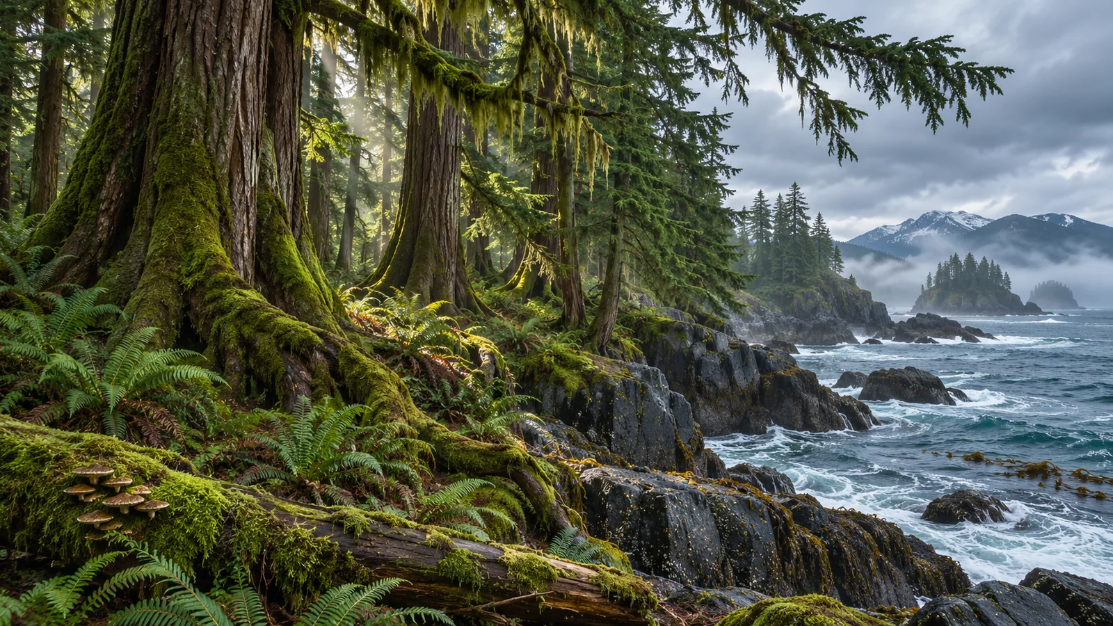
From shore, you may only see a small bird sitting low on the water before it dives. A flight inland could take it far beyond the trees you can see from the same viewpoint. The beach and the forest are easy for a person to think of as separate places. For the murrelet, the distance and conditions between them are part of its routine when it has a chick to feed.
What the murrelet needs at sea
The marbled murrelet is an auk. Its wings let it pursue prey below the surface. Canada’s recovery strategy describes it foraging primarily in nearshore water, including inlets, channels and waters around islands. The exact distribution varies with conditions and food availability. A bird may use the water to rest between dives, and a sheltered area may provide both prey and a place to spend time at the surface.
During breeding, small fish such as Pacific sand lance and Pacific herring are important prey. The adults eat fish and can carry fish back to the chick. Invertebrates such as krill and small squid can also form part of the diet, especially outside the breeding season. The marine habitat includes the places those prey species need. Sand lance use suitable sediment to bury. Herring use certain shallow habitats to spawn. Water depth and currents can affect whether prey are available within a diving bird’s reach.
Think of what a bird can reach on one dive. A school of fish can be nearby but too deep or too dispersed to offer a good feeding opportunity. If the fish come into range, the bird may dive several times in the same patch. Seeing a murrelet at the surface gives you its location at that moment. Seeing it dive adds evidence of activity. Identifying the prey or judging how much the bird caught generally requires a better view or a different method.
What old forest provides
The typical murrelet nest in BC is a suitable platform in the canopy of a large conifer. A broad limb or a deformity can offer a stable surface. Moss or other soft material provides the immediate place for the egg. Gaps in the canopy allow the bird to approach or leave. The murrelet lays a single egg without building a stick nest. Both adults incubate and later bring fish to the chick. A small number of nests have been found on mossy cliff ledges, though large trees provide the usual setting in BC. BC Conservation Data Centre marbled murrelet status report
The age of a forest is a clue to the structures it may contain. What the bird needs is a physical combination it can use, including a broad enough platform, cover and access through the canopy. Two stands that look equally tall from the road can differ in limb size and structure. Researchers in British Columbia have used airborne laser scanning data to model potential nesting habitat using information about canopy structure. A model helps identify likely habitat across a large area. Ground or other direct observations can refine what is known about a particular place. BC study modelling nesting habitat with airborne laser scanning
A suitable nest can be hard to see from below. It may be high above a forest floor with several layers of branches between the observer and the bird. The adult’s breeding plumage is mottled brown, which blends with the nest setting. The bird can enter or leave rapidly, and murrelets typically nest as dispersed pairs. These features make it difficult to find nests by looking for an obvious colony or a collection of stick nests.
The two habitats need to work together
A chick on a branch can receive food only if an adult catches prey and carries it inland. A forest can contain suitable nest platforms while offering no marine food on its own. A stretch of coast can support feeding birds while the nest habitat they rely on lies farther inland. The connection is especially important during breeding, when the adults make trips between the two. The recovery strategy uses the proximity of marine habitat to suitable inland nesting habitat as one consideration for the species.
Imagine a bird feeding close to shore, then flying inland with a fish. It must leave the water, cross the coast and reach the branch. Those steps are visible at different points to different observers. Someone on a boat might see the bird catch a fish and disappear inland. An observer in a watershed might detect a bird flying towards the trees without knowing where it fed. A study can combine observations from both environments to ask how the routes connect, but a single encounter rarely shows the entire trip.
The relationship also helps explain why habitat can vary in value at different times of year. A marine feeding area near nesting habitat can be especially useful when adults are carrying food inland. A bird outside the breeding season has other considerations when it chooses where to feed and rest. A map based on breeding observations answers a specific seasonal question. If you compare it with a winter sighting, check whether you’re looking at the same period and the same kind of habitat use.
Why one survey cannot see the whole population
A survey at sea can record birds on the water and give researchers information about where murrelets gather or forage. Birds inland during the survey or underwater when observers pass can be missed. A count still has value when the routes and methods are documented. It gives a view of the birds available to be detected in the sampled area and conditions.
On land, researchers can use radar to count flights into or out of suitable watersheds. In some studies they have also used radio telemetry to track birds and find nesting locations. Radar can reveal movement where nests are difficult to see. A radar count measures passes under the survey protocol, while a located nest gives direct evidence that a bird used a particular site. A habitat model supplies another kind of evidence. Used together, the methods help link marine use, flight activity and terrestrial habitat. Simon Fraser University summary of marbled murrelet recovery research BC Conservation Data Centre status report
Think about a forest where a survey finds few flights one morning. The result could reflect the timing of the visit, the birds’ use of other routes or low activity in that area. A series of comparable surveys gives scientists more to work with. In the same way, a group of birds seen at sea on a given day tells you where birds were concentrated at that moment. It does not give an immediate count of breeding pairs. The best interpretation starts with what the method was designed to detect.
What recovery work addresses in each place
The federal recovery strategy identifies loss and fragmentation of nesting forest as major threats. Losing an old tree can remove a platform with features that take a long time to develop. The surrounding canopy can also matter because it affects access and conditions around the platform. Protecting suitable habitat involves understanding the physical features of the stand and where it sits in relation to other nesting areas and the marine waters used for feeding.
Marine threats in the strategy include oil pollution, entanglement in fishing gear and changes that affect prey habitat or availability. These can act on the adult or on the food available for a chick. An at-sea issue can matter even when a forest still offers good nest platforms. Similarly, suitable foraging water cannot replace a missing platform in the forest. The recovery strategy describes features of critical habitat on land and in the marine environment, reflecting the different roles each plays.
How to read a map of potential habitat
A forest map may use tree height, age or canopy structure to show where nests could occur. A marine map may combine records of birds with information about depths, currents or potential prey habitat. The shading on each map refers to the evidence or criteria named in its legend. If a map shows suitable forest, the highlighted area does not give the location of an individual nest. If a marine area is identified in a recovery strategy, the document explains which habitat features support the species there and the information used to delineate the area. BC study modelling nesting habitat
Try comparing the two maps at a scale that shows the coast and several watersheds together. Nearby feeding water and potential nesting stands form a plausible connection, even if there is no direct flight record drawn between them. A more detailed study may add known flight directions, tracking data or field verification of the forest structure. Each piece of information reduces uncertainty about a different part of the connection. The maps also show why the two habitats can change independently. New evidence about a prey species may change an assessment of marine habitat without saying anything about nest platforms inland.
What you can recognise from the BC coast
On the water, look for a small, compact seabird with rapid wingbeats in flight or a low outline when it sits on the surface. Breeding adults have mottled brown plumage. In non-breeding plumage, the birds are more strongly black and white. Those seasonal changes can affect how well a field illustration matches a bird you see. Distance can hide the plumage altogether. Keep the identification provisional when you see only a small auk flying low or a dark shape disappearing beneath a wave.
From a public viewpoint near Campbell River, stay where you can observe without displacing birds. If you see a bird dive, remember the last position and look across the surrounding water for its next appearance. Keep track of whether it surfaced with prey and which direction it flew. Those details have value even if a species identification remains uncertain. Eagle Eye Adventures’ guide to wildlife beyond whales around Campbell River provides context for other animals you might see along the same coast.
Do all marbled murrelets nest right beside the water?
Nests can occur well inland. The federal strategy describes many nests within tens of kilometres of the sea and records some farther away. A bird feeding near shore may therefore make a trip into forest that is out of sight of a person watching the water. The next time you see a small auk dive near an island or inlet, consider the two distances involved. One is the depth it travels to reach prey. The other is the inland trip it may make to a nest. Both help explain why the coast and old forest belong in the same account of this bird.
A bird seen feeding close to shore may have travelled from a nesting area you cannot see from the water.
A bird seen feeding close to shore may have travelled from a nesting area you cannot see from the water.